


Rillito Park Tucson River Path Walk

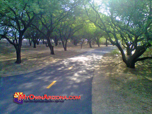
Tucson River Walk Photo
The City of Tucson has connected paths along the Santa Cruz and Rillito rivers, creating a picturesque 24-mile route for pedestrians, runners and bicyclists of all skill levels from West Silverlake Road to North Craycroft Road in Tucson AZ. This is quickly becoming Tucson’s center-point for all those wanting to take in the city’s many splendid views.
The Rillito Park Tucson River Path is popular with cyclists, runners and walkers, this 24 mile round trip on Tucson’s north side follows the banks of the Rillito — Spanish for “little river.” Both north and south riverbanks feature developed paved trails. This route winds the traffic and pedestrian bridges to sample this bike-friendly City of Tucson’s best features.
What will eventually be 55 miles of paved and granite paths around Tucson for residents and visitors on foot, bikes, skates and horses. Over 40% of the metropolitan Tucson population lives within one-mile of the loop.
Tucson River Walk Photo
Starting at the Craycroft Road trailhead, follow the asphalt path along the north bank, heading west. The trail dips under major roads. Though this east-west route looses about 200 feet of elevation, the incline is barely noticeable on the return trip.
Restrooms, rest points and easy-access parking are located conveniently along the Rillito Park Tucson River Path Walk trail, but bring plenty of water especially in
summer and protect yourself from the sun. You will cruise under occasional trees. The Rillito Park Tucson River Path Walk path runs from I-10 to Craycroft Road on the north (11.75 miles) and south (12.5 miles) banks of the Rillito River.
Amenities Provided:
- ADA accessible facilities
- bicycling
- drinking water
- equestrian access
- exercise stations
- hiking and walking
- restrooms
- wildlife viewing
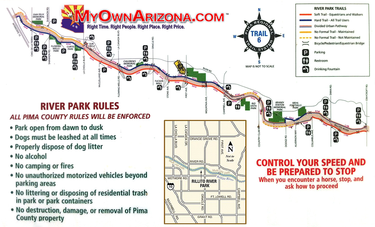
Tucson River Walk Clickable Map
To learn more about Tucson’s Attractions and to take a tour of the area, please contact me.
My best,
Carl F. Pepper, Realtor
carl@MyOwnArizona.com
www.MyOwnArizona.com
(520) 822-6575


 Posted in
  Tags:
Tags: